India Deepens Satellite-Based Services Across Key Sectors, Parliament Informed
New Delhi, December 4: Space technology is now embedded across India’s governance framework, powering applications in agriculture, disaster management, urban planning and telecommunications, the Department of Space informed Parliament on
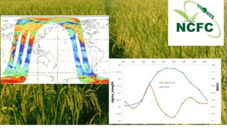
The Mahalanobis National Crop Forecast Centre (MNCFC) has operationalised satellite-enabled acreage estimation, pre-harvest production forecasting, drought assessment, horticulture mapping and yield estimation under various schemes, including the Pradhan Mantri Fasal Bima Yojana.
New Delhi, December 4: Space technology is now embedded across India’s governance framework, powering applications in agriculture, disaster management, urban planning and telecommunications, the Department of Space informed Parliament on Wednesday. The updates were shared in a written reply during the ongoing Winter Session.
Satellite-based systems are playing a growing role in crop forecasting, risk mitigation, and real-time monitoring of natural disasters. The Mahalanobis National Crop Forecast Centre (MNCFC) has operationalised satellite-enabled acreage estimation, pre-harvest production forecasting, drought assessment, horticulture mapping and yield estimation under various schemes, including the Pradhan Mantri Fasal Bima Yojana. Using multispectral and microwave data, MNCFC supports 557 districts across 20 states.
In disaster management, satellites from the INSAT and EOS series are enabling continuous monitoring of cyclones in the Northern Indian Ocean, providing early warnings on cyclogenesis, intensity and landfall. ISRO is supplying flood inundation maps to state disaster management authorities during riverine and cyclone-driven floods, while developing hazard zonation for major flood-prone states. Under the National Hydrology Project, glacial lakes across the Himalayas have been mapped and GLOF risk models have been prepared for prioritised sites.
ISRO also provides near real-time forest fire alerts up to eight times a day during peak season. Landslide inventories, damage assessments for landslides and earthquakes, and a national drought assessment portal built with the agriculture ministry form part of the expanded disaster response ecosystem.
Urban development agencies are using very high-resolution satellite data for geospatial mapping under the AMRUT programme. The data supports preparation of modern, GIS-integrated master plans for several cities.
The Department of Space said participation from India’s private sector—still in its early stages—is critical to meeting rising national demand for satellite-enabled solutions. Reforms enabling private involvement have led to rapid growth among space startups working on launch vehicles, satellite manufacturing, Earth observation networks, analytics, SATCOM and PNT services. Firms such as Skyroot, Agnikul and Ananth Technologies are advancing indigenous capabilities in launch services and satellite manufacturing.
To accelerate adoption of space applications across ministries and industry, IN-SPACe has launched several programmes, including the Space Applications Adoptions Workshop series, technology handholding sessions and structured capacity-building initiatives. Funding tools such as the Seed Fund and Technology Adoption Fund aim to support startups and MSMEs by covering a defined share of project costs. IN-SPACe has also initiated a PPP model to develop an indigenous Earth observation system.
Officials said expanded private participation and increased deployment of satellite-based services across sectors are expected to contribute significantly to the growth of India’s space economy by 2033, fostering high-tech exports, investment and skilled employment.