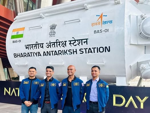
NISAR Satellite Launch Marks New Era in Earth Observation, Indo-US Space Cooperation
As India cements its place in the global space ecosystem, NISAR stands as a testament to the power of international collaboration, indigenous capability, and science diplomacy.
Dual-frequency radar satellite to boost aviation safety, coastal planning, and climate science with open-access global data
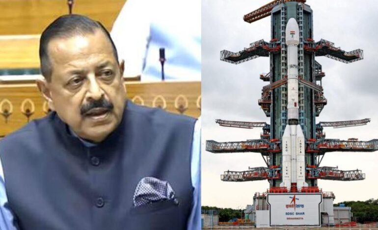
New Delhi/Sriharikota, July 31: In a landmark achievement for international space collaboration, the NASA-ISRO Synthetic Aperture Radar (NISAR) satellite was successfully launched on Wednesday aboard ISRO’s GSLV-F16 rocket from the Satish Dhawan Space Centre, ushering in a new era of precision Earth observation and cross-sectoral impact.
Developed jointly by NASA and ISRO, NISAR is the world’s first Earth observation satellite to carry dual-frequency synthetic aperture radars—L-band by NASA and S-band by ISRO—on a single platform. The 2,393-kg satellite was placed into a 747-km Sun-synchronous Polar Orbit, marking a technological milestone for ISRO as it became the first GSLV flight to achieve this orbit.
Union Minister Dr Jitendra Singh, who watched the launch remotely from Delhi due to Parliamentary duties, hailed the mission as a “global benchmark” in scientific partnership. “NISAR is not just a satellite; it is India’s scientific handshake with the world,” he said, while addressing scientists and officials gathered at the CSIR Auditorium.
Broader Impact Beyond Earth Observation
Though originally designed for disaster management, climate tracking, and glacier monitoring, NISAR’s data will also revolutionize sectors such as aviation safety, maritime navigation, urban infrastructure, and coastal management, Dr Singh emphasized.
“This satellite represents a striking shift in how we plan national infrastructure, monitor shipping lanes, and optimize air traffic. It is science in service of society,” he said.
With revisit cycles every 12 days and round-the-clock, all-weather capabilities, NISAR will provide high-resolution data critical for climate scientists, policymakers, and emergency responders. The open-access policy for NISAR’s data is expected to benefit not just India and the US, but also developing nations, research institutions, and international disaster-response agencies.
Deep Technical and Strategic Collaboration
The mission—estimated to cost over $1.5 billion—represents one of the most ambitious partnerships between the two space agencies. While NASA provided the L-band radar, 12-meter deployable antenna, GPS receiver, and high-speed data transmission systems, ISRO contributed the S-band radar, the I-3K spacecraft bus, and the GSLV-F16 launch vehicle.
This was the 18th flight of the GSLV and the 12th using its indigenous cryogenic stage, reaffirming ISRO’s growing technological maturity and reliability in complex space missions.
Visionary Push Under PM Modi
Dr Jitendra Singh noted that Prime Minister Narendra Modi’s vision is pushing India’s space programme beyond utility-based applications into knowledge-driven missions. “From Chandrayaan to NISAR, we are not just launching satellites—we are launching new possibilities for global science, sustainability, and shared progress,” he remarked.
With a five-year mission life, NISAR is expected to generate transformative datasets for applications in seismic studies, forest cover mapping, agricultural productivity, and resource management. The satellite’s real-time, dual-frequency radar technology positions it as a critical tool in confronting the global climate crisis.
As India cements its place in the global space ecosystem, NISAR stands as a testament to the power of international collaboration, indigenous capability, and science diplomacy.