Government expands technology-driven crop monitoring with AI, satellites and drones
BharatVistaar has served over 5.9 lakh farmers and addressed more than 93 lakh queries, while AI-based systems are helping detect pests and generate location-specific farm advisories.
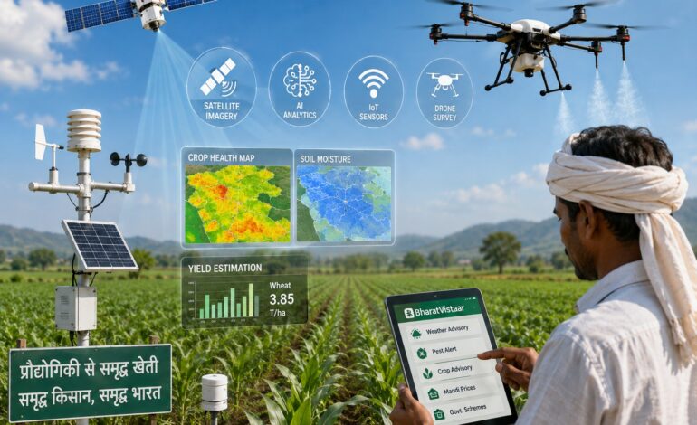
The technology architecture combines remote sensing, Geographic Information Systems (GIS), satellite imagery, artificial intelligence, Internet of Things (IoT) and drone-based applications to support crop management and improve the delivery of agricultural services.

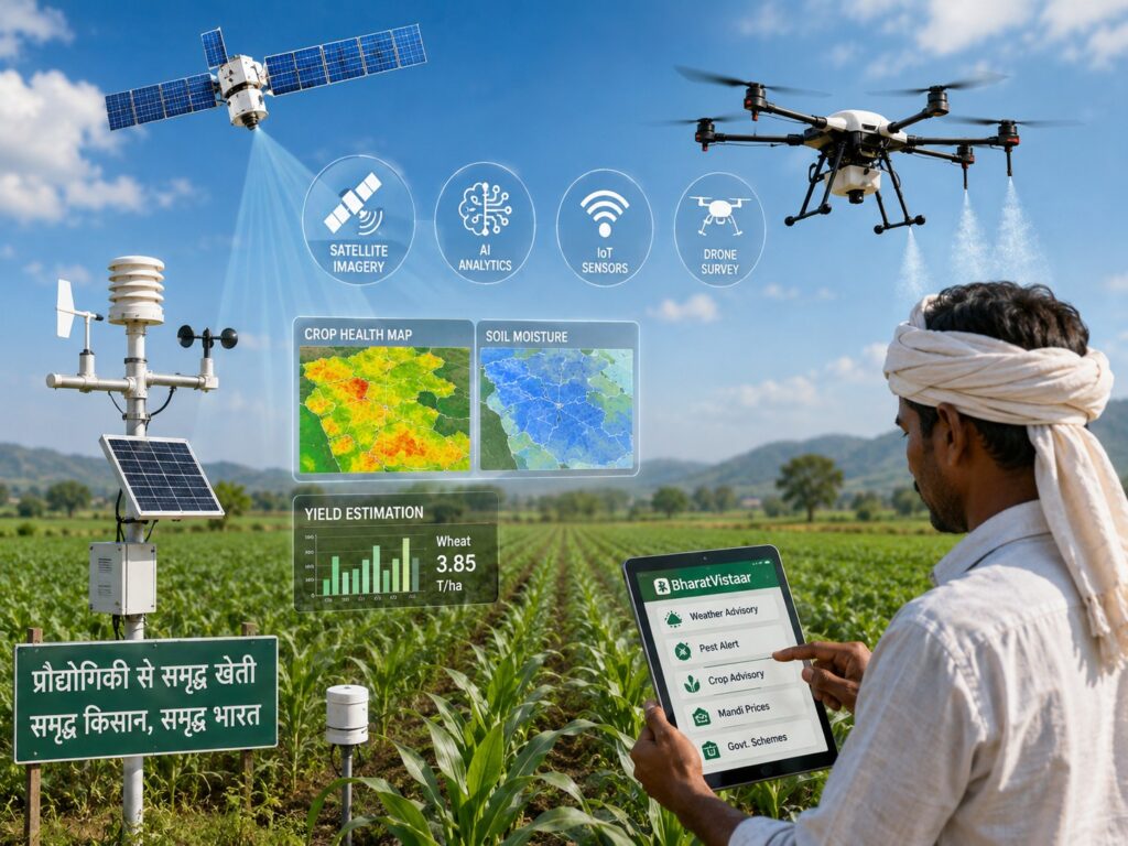
NEW DELHI: India is increasingly using satellites, drones, artificial intelligence and digital platforms to monitor crops, assess weather and disaster risks, estimate yields and deliver farm advisories, as the government expands technology-driven agriculture across the country.
The technology architecture combines remote sensing, Geographic Information Systems (GIS), satellite imagery, artificial intelligence, Internet of Things (IoT) and drone-based applications to support crop management and improve the delivery of agricultural services.
The information was provided by Minister of State for Agriculture and Farmers Welfare Ramnath Thakur in a written reply in the Lok Sabha on Tuesday.
Satellite data moves into crop management
Satellite-based monitoring is being used for everything from estimating crop production before harvest to assessing the impact of droughts, floods and other weather-related events.
The Forecasting Agricultural output using Space, Agro-meteorology and Land-based observations (FASAL) system uses multispectral and Synthetic Aperture Radar satellite data to generate pre-harvest production forecasts at national, state and district levels.
FASAL currently covers 11 major crops — paddy, wheat, jute, cotton, sugarcane, soybean, tur, gram, mustard, lentil and rabi sorghum — across 20 states.
The government’s Mahalanobis National Crop Forecast Centre (MNCFC) also generates remote-sensing inputs covering vegetation conditions, soil moisture, drought conditions, flood inundation and hailstorm impacts to support crop management and disaster assessment.
A broader digital layer comes through the Krishi Decision Support System, which integrates satellite, weather, soil, crop-signature, reservoir and groundwater data with information relating to government schemes.
The platform supports evidence-based decision-making and is also intended to provide research institutions and the agritech industry with data that can be used to develop new solutions.
Krishi-DSS data is being used for crop-map generation, identification of crop-sown patterns and diversification, drought and flood monitoring, and technology- and model-based yield assessment for settling crop insurance claims.
Technology enters crop insurance
The government is also using technology to improve crop-yield estimation under the Pradhan Mantri Fasal Bima Yojana (PMFBY).
The Yield Estimation System based on Technology, or YES-TECH, incorporates satellite-based crop-yield models to estimate yields at the Gram Panchayat level and support claim settlement.
The system is currently being implemented for paddy, wheat and soybean across 12 states.
Weather monitoring is being strengthened through WINDS — the Weather Information Network and Data System — a national initiative under PMFBY.
The programme seeks to augment India’s weather-data infrastructure by expanding the network of Automatic Weather Stations at Block, Tehsil and Taluk levels and Automatic Rain Gauges at the Gram Panchayat level.
WINDS is currently being implemented in seven states.
Drones take agriculture into the air
Drones are emerging as another tool in India’s technology-driven agriculture strategy.
Under the Sub-Mission on Agricultural Mechanization, financial assistance is provided for the procurement of Kisan drones.
Agriculture graduates and small and marginal farmers in the northeastern states can receive assistance of up to 50% for procuring Kisan drones, while other farmers are eligible for assistance of 40% of the cost.
Similar 40% financial assistance is available for establishing custom hiring centres for Kisan drones.
A total of 2,122 drones have been distributed or approved under the scheme.
The government is also using drones as part of a women-led agricultural service model.
Under the Namo Drone Didi Central Sector Scheme, selected women’s self-help groups are being equipped with drones so that they can provide rental services to farmers for agricultural applications, including spraying fertilisers and pesticides.
According to information provided by the Department of Fertilizers, 1,094 drones have been distributed to Drone Didis belonging to Self-Help Groups.
The participating women have also been trained at Remote Pilot Training Organisations authorised by the Directorate General of Civil Aviation.
AI moves closer to the farm
Artificial intelligence is being deployed not only for analysing large volumes of agricultural data but also for addressing problems directly faced by farmers.
The National Pest Surveillance System uses AI and machine learning to detect pest infestations and crop-related problems, enabling timely intervention.
Farmers can capture images of pests through the system to help identify infestations and respond to potential crop losses.
The system currently covers 73 crops and 436 pests.
AI-based analytics using field photographs are also being used alongside satellite-based crop mapping for crop-weather matching and monitoring of crops sown.
As of the latest data, 35,565 advisories had been issued through the application.
BharatVistaar brings AI-based advice to farmers
Another major component of the government’s agricultural digital architecture is BharatVistaar — the Virtually Integrated System to Access Agricultural Resources.
The multilingual AI-powered Digital Public Infrastructure for Agriculture is designed to provide farmers with real-time, location-specific agricultural advisories as well as access to government schemes and support services.
The platform has so far served more than 5.9 lakh farmers and addressed over 93 lakh farmer queries.
BharatVistaar provides information covering 18 Central Government schemes, along with crop and livestock advisories, weather forecasts, mandi prices, pest and disease identification, soil-health-based recommendations and grievance redressal.
The service is available through a chatbot via a web portal and mobile application, as well as through a dedicated telephone line.
The emphasis is significant because it moves digital agriculture beyond back-end government monitoring and places technology directly in the hands of farmers seeking information.
Kisan Sarthi reaches nearly 3 crore farmers
The government’s digital agriculture ecosystem also includes Kisan Sarthi, an ICT-based platform developed by the Indian Council of Agricultural Research.
Krishi Vigyan Kendras use the platform to provide crop-specific advisories to farmers.
More than 2.97 crore farmers are registered on Kisan Sarthi across the country.
Together, platforms such as BharatVistaar and Kisan Sarthi are creating multiple digital channels through which farmers can access information and expert guidance without depending entirely on physical extension services.
AgriStack connects farmer data with schemes
The technology push is also being integrated with government schemes through the AgriStack project under the Digital Agriculture Mission and other remote-sensing and information-system initiatives.
These systems are being used to improve the targeting of beneficiaries for Direct Benefit Transfers under PM-KISAN, support Minimum Support Price-based procurement through the Food Corporation of India and facilitate fertiliser booking.
They are also intended to support faster and more accurate settlement of PMFBY claims.
The government says the digital infrastructure has enabled faster delivery of services in areas such as disaster-relief disbursement in Maharashtra and sanctioning of Kisan Credit Card loans within half an hour.
Digital systems are also being used to improve farmer outreach for participation in procurement schemes.
Farmer ID becomes a common digital link
The Farmer ID is emerging as an important component of this digital architecture.
It is being used for enrolment under PMFBY, procurement under the Price Support Scheme of PM-AASHA and linkage with Soil Health Cards to support crop and input planning.
Digital Crop Survey data is also being used to generate near real-time crop production estimates.
The objective is to create a more integrated information base around the farmer, the land, the crop and the services being delivered.
Technology also reaches natural farming
The government’s technology-driven approach extends to natural farming.
Under the National Mission on Natural Farming, geo-referencing of natural farms and clusters is being captured through the Krishi MApper application.
This provides a digital layer for identifying and mapping natural-farming areas as the government expands the use of geospatial technologies in agriculture.
From satellite to smartphone
The emerging architecture shows how technology is being inserted into almost every stage of the agricultural cycle.
Satellites can help identify what is being cultivated and estimate production. Remote sensing can assess drought, floods and crop conditions. Drones can deliver farm services. AI can identify pests and generate advisories. Weather networks can improve local data. Digital platforms can connect farmers with information and government schemes.
The bigger shift is that these technologies are no longer operating as isolated pilots.
They are increasingly being connected with crop insurance, procurement, welfare transfers, credit, soil-health planning and agricultural advisories.
India’s technology-driven crop monitoring system is therefore evolving from simply observing farms from above to creating a digital decision-support ecosystem around the farmer.
The government’s stated objective is more accurate information, faster delivery of services and better targeting of agricultural interventions.
For farmers, the ultimate measure will be whether that increasingly sophisticated digital infrastructure translates into something much more tangible — better decisions in the field, lower crop losses, faster insurance settlements and easier access to the services they need.